博客
Best GEO Tools for NYC Startups

Best GEO Tools for NYC Startups
For NYC startups navigating the city's $2 trillion economy, the right geospatial tools provide critical competitive advantages through neighborhood analytics, precise geocoding, and location intelligence. Platforms like Ginkgo save 15-20% of operational time while the city's Live NYC Map offers real-time data on 150,000+ storefronts updated every 90 days, giving founders unprecedented market visibility.
Key Takeaways
• Free geocoding options: Mapbox offers 100,000 free requests monthly while HERE provides 250,000 transactions, significantly outpacing Google's 10,000 request limit
• Budget-friendly GIS: QGIS provides enterprise-level spatial analysis at zero cost, while Google Earth Pro dropped from $400 annually to completely free
• City-specific tools: NYC Geo transforms text into authoritative city addresses using Property Address Directory data, solving Manhattan's complex addressing challenges
• BID intelligence platforms: Over 500 users across 15 City agencies utilize Live NYC Map for real-time storefront tracking
• ROI-driven insights: Location analysis reveals Corona Park averaging $6,128 weekly sales versus SoHo's $5,911, enabling data-driven site selection
New York City's startup ecosystem runs on a different speed than the rest of the country. With the 9th largest economy in the world generating $2 trillion in gross metropolitan product, founders here compete for every advantage possible. That's where GEO tools for NYC startups become essential--not the generative engine optimization kind, but the geospatial platforms that surface foot-traffic patterns, address data, and climate-risk insights that can make or break a new venture.
Why GEO tools matter for New York's hyper-competitive startup scene
The NYC startup ecosystem operates at an unprecedented scale, with the largest workforce in the nation comprising 4 million workers. In this environment, generative engine optimization represents a new frontier for visibility. Studies show companies achieve a 67% increase in AI platform visibility with proper GEO implementation, making content 3.2x more likely to be cited in AI responses.
But beyond digital optimization, NYC founders need tangible geographic intelligence. The rapid adoption of generative AI-powered engines like ChatGPT and Perplexity is fundamentally reshaping how startups approach market analysis and location-based decisions. These platforms move beyond traditional ranked lists to synthesized, citation-backed answers that can inform everything from retail site selection to service area planning.
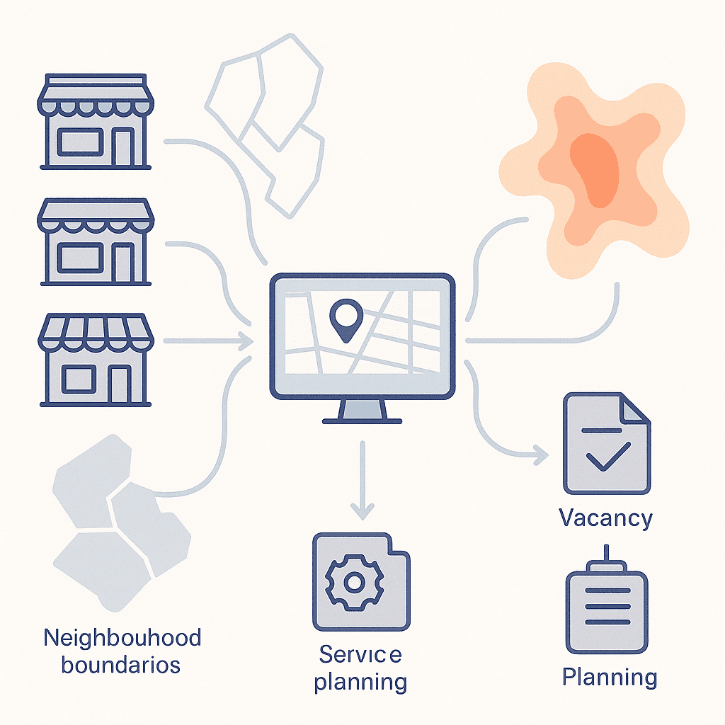
Neighborhood & BID Management Platforms
Business Improvement Districts (BIDs) form the backbone of NYC's commercial corridors, and the right geospatial tools can unlock critical insights about neighborhood dynamics. As one BID executive noted, "Ginkgo's geospatial platform is pivotal in measuring the impact of our BID services, from managing the public realm to tracking storefront vacancy and new business openings."
The city's own Live NYC Map features real-time comprehensive data on over 150,000 storefronts updated every 90 days. This unprecedented level of detail helps startups understand their local market with precision previously unavailable to small businesses.
For foot-traffic analysis, platforms like UrbanLogiq provide New York City Business Improvement Districts with centralized data to analyze and report on business activity. These tools are particularly valuable for understanding pre and post-COVID-19 traffic patterns that continue to reshape the city's commercial landscape.
Ginkgo
Ginkgo stands out for its BID-focused capabilities and significant time savings. According to users, "Having our operations centralized around Ginkgo saved on average 15% to 20% of the time" compared to other solutions. The platform helped NYC's Small Business Resource Network measure engagement with over 40,000 small businesses, 60% of which are located in Low to Medium Income areas.
Live NYC Map
The city's Live NYC Map represents a game-changer for real-time storefront intelligence. With more than 500 users across 15 City agencies and nearly all BIDs already utilizing the platform, it provides the most accurate verified snapshot of the city's commercial landscape to date.
Where can you find authoritative geocoding & address services?
Accurate geocoding forms the foundation of any location-based startup, and NYC offers both city-specific and global options. NYC Geo transforms input text into authoritative New York City addresses using data from the Property Address Directory, providing the kind of precision that generic geocoding services often miss in Manhattan's complex addressing system.
For startups watching their burn rate, pricing varies dramatically across providers. Google offers 10,000 requests per month free, with additional requests billed at $5 per 1,000. Meanwhile, Mapbox offers a generous free tier of 100,000 requests per month, making it particularly attractive for early-stage companies.
The modernization of NYC's geocoding infrastructure continues to evolve. The Geosupport System is the city's primary geocoding software service, currently undergoing modernization to transition from legacy mainframe systems to modern cloud-based architectures.
NYC Geo & Geosupport
For startups requiring authoritative city data, NYC Geo is built on Pelias, the open source geocoding engine that previously powered Mapzen. The Geosupport System, initially developed by DCP in the early 1980s, remains a critical resource for election districting, property tax assessment, and urban planning initiatives--all valuable data points for location-aware startups.
What budget-friendly GIS & mapping software options exist?
Navigating GIS software pricing can drain a startup's budget faster than a Manhattan lease. Fortunately, QGIS offers a versatile platform for data analysis and map creation at zero cost, fundamentally changing the economics of spatial analysis for budget-conscious organizations.
For those needing more user-friendly interfaces, Maptive starts at $250 for a 45-day pass, with annual subscriptions priced at $1,250 per user. This positions it as a practical choice for businesses seeking professional mapping capabilities without enterprise-level complexity.
Google Earth Pro represents another compelling option, having transitioned from a $400 annual subscription to completely free access. This democratization of previously premium tools gives startups access to global imagery that was once reserved for well-funded organizations.
QGIS (free, open source)
QGIS stands as the backbone of budget-conscious spatial analysis. Enhanced by tools like Mergin Maps which enables real-time field data capture, QGIS provides a complete GIS stack without licensing fees.
Maptive & Google Earth Pro
For startups needing quick wins without heavy technical lifts, Maptive has positioned itself as the best solution for businesses seeking professional mapping capabilities. Combined with Google Earth Pro's free access to global imagery, these tools provide comprehensive mapping solutions without breaking seed-stage budgets.
What sector-specific spatial data tools deliver edge insights?
NYC startups can tap into highly specialized geospatial datasets that provide competitive advantages in specific verticals:
Food & Retail Location Intelligence:
Corona Park locations average $6,128 weekly sales
Penn Station averages $5,975 weekly sales
SoHo averages $5,911 weekly sales
Transit & Mobility Analytics:
MTA's partnership with CitySwift achieved an 80% reduction in incidents through AI-optimized runtimes, while near-miss reporting increased by 10%.
Climate & Energy Efficiency:
Monarch Realty Holdings' Upper Manhattan properties secured $83,074 in incentives through geospatial analysis of building insulation needs, ultimately saving $52,000 annually on energy costs.
These sector-specific tools demonstrate how targeted spatial data can drive immediate ROI for startups operating in NYC's diverse markets.

How can founders choose the right GEO stack & control costs?
Selecting the right geocoding API requires balancing volume needs with budget constraints:
Free Tier Comparison:
Mapbox: 100,000 requests per month
HERE: 250,000 transactions per month on Freemium plan
Google: $200 monthly credit (approximately 40,000 lookups)
OpenCage: 2,500 requests daily
Cost Control Checklist:
Match your expected volume to provider tiers
Understand storage restrictions (Google and TomTom prohibit permanent storage)
Consider open-source alternatives for high-volume needs
Leverage caching where license terms allow
Batch process requests during off-peak hours
For GIS software, pricing ranges from $100 for individual use to $3,800 for enterprise editions of ArcGIS. Most startups find the sweet spot in mid-tier options or open-source solutions enhanced with commercial support.
Key takeaways for founders ready to map their next move
NYC's hyper-competitive funding landscape demands every possible advantage. The right GEO tools, whether for neighborhood intelligence, precise geocoding, or sector-specific insights, can provide the edge needed to succeed. With FAQ sections increasing AI citation rates by up to 35%, combining traditional geospatial tools with generative engine optimization creates a powerful dual approach to market visibility.
For startups ready to leverage both geographic and generative intelligence, the path forward is clear: start with free tiers to validate your approach, then scale up as revenue grows. The 9th largest economy in the world offers unprecedented opportunities for those who know how to navigate its geography, both physical and digital.
Whether you're optimizing foot traffic for a food truck or building the next proptech unicorn, NYC's expanding ecosystem of GEO tools provides the foundation for data-driven growth. And for companies looking to maximize their visibility across both traditional search and AI-powered platforms, solutions like Relixir's comprehensive GEO platform can help ensure your startup gets found, and recommended, by the systems that increasingly shape customer discovery.
Frequently Asked Questions
What are GEO tools and why are they important for NYC startups?
GEO tools provide geospatial insights such as foot-traffic patterns and address data, crucial for NYC startups to make informed decisions in a competitive market. They help optimize visibility and location-based strategies, essential for success in New York's dynamic environment.
How do Business Improvement Districts (BIDs) benefit from geospatial platforms?
BIDs use geospatial platforms to measure the impact of their services, track storefront vacancies, and manage public spaces. Tools like Ginkgo and UrbanLogiq provide valuable data for analyzing business activity and understanding neighborhood dynamics, crucial for effective BID management.
What are some budget-friendly GIS and mapping software options for startups?
Startups can use QGIS, a free and open-source platform, for spatial analysis and map creation. Maptive offers professional mapping capabilities at a lower cost, and Google Earth Pro provides free access to global imagery, making these tools accessible for budget-conscious startups.
How can startups choose the right geocoding API?
Startups should consider their volume needs and budget constraints when selecting a geocoding API. Options like Mapbox, HERE, and Google offer free tiers, while open-source alternatives can be cost-effective for high-volume needs. It's important to match expected volume to provider tiers and leverage caching where possible.
What sector-specific spatial data tools are available for NYC startups?
NYC startups can access specialized geospatial datasets for competitive advantages in sectors like food, retail, transit, and energy. These tools provide insights into sales patterns, mobility analytics, and energy efficiency, helping startups drive ROI and make data-driven decisions.
Sources
https://www.ginkgo.city/post/measuring-small-business-assistance
https://www.nyc.gov/site/sbs/about/pr20231122-livenycmap.page
https://urbanlogiq.com/how-urbanlogiq-supports-business-improvement-districts/
https://www.linkedin.com/advice/0/what-most-cost-effective-geospatial-qaqxe
https://gmapswidget.com/the-5-best-mapping-software-for-businesses-in-2025

